

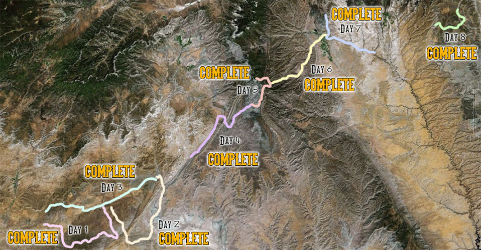
The proposed route starts in the southwest portion of GSENM and ends in the northeast portion at the Lampstand, near the border with Capitol Reef National Park. It traverses the entire Monument, mostly used roads and existing trails. Approximately 7 percent of the route is cross country, mostly utilizing stream bottoms (Paria River) or dry washes (Buckskin Gulch, Wahweap Creek), but there will be approximately 2-3 miles of cross- country upland travel (in the headwaters area of Wahweap Creek and up Fossil Ridge) by the runners (not the support crew). All UTM coordinates given below are in NAD 83.